Trail Walking Dihlabeng Local Municipality - Afrique du Sud - Golden Gate Highlands National Park  - Photo
© OpenStreetMap contributors
Length
Length
10.2 km
Max alt
Max alt
2417 m
Uphill gradient
Uphill gradient
699 m
Km-Effort
Km-Effort  
19.5 km
Min alt
Min alt
1916 m
Downhill gradient
Downhill gradient
700 m
Boucle
Boucle
Yes
Creation date :
2024-07-13 08:28:16.0
Updated on :
2025-01-30 21:42:27.808

(0 Reviews)

Walking
Walking
4h26
Difficulty : Difficult

Scan this QR Code to open this trail in the SityTrail application

FREE GPS app for hiking

Logo SityTrail SityTrail

IGN / Geographical institutes

Download SityTrail from the App Store Download SityTrail from Google Play

Logo SityTrail SityTrail World

The world is yours!

Download SityTrail from the App Store Download SityTrail from Google Play Download SityTrail on Huawei AppGallery

About

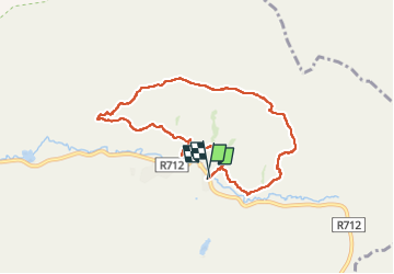
Trail Walking of 10.2 km to be discovered at Free State, Thabo Mofutsanyana District Municipality, Dihlabeng Local Municipality. This trail is proposed by nicolasbarbarin.

Elevation profile

Positioning

Country:
South Africa
Region :
Free State
Department/Province :
Thabo Mofutsanyana District Municipality
Municipality :
Dihlabeng Local Municipality
Location:
Unknown
Start:(UTM)
658332 ; 6845684 (35J) S.

Trails nearby

Trail Walking Dihlabeng Local Municipality - Golden Gate rando complete  - Photo
Walking
jm_benard

Walking

Difficult
Dihlabeng Local Municipality, Free State, Thabo Mofutsanyana District Municipality, South Africa
10.4 km | 18.5 km-effort
3h 31min
Yes
Trail Walking Dihlabeng Local Municipality - Golden Gate rando 1 - Photo
Walking
jm_benard

Walking

Medium
Dihlabeng Local Municipality, Free State, Thabo Mofutsanyana District Municipality, South Africa
3.2 km | 6.7 km-effort
52min
Yes


Close
My subscriptions